
Basin 14: Stevens, Wells, Waits, Ompompanoosuc (2020)
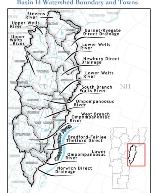
Basin 14 comprises multiple sub-basins including the Stevens, Wells, Waits, and Ompompanoosuc Rivers, and five Connecticut River tributaries. The basin stretches south, from Peacham to Hartford, draining portions of Caledonia, Orange, and Windsor Counties and covers significant areas of 17 individual towns. The Basin 14 Tactical Basin Plan was updated in 2020. Overwhelmingly, the waters in Basin 14 meet or exceed water quality standards. Yet, there are still 69 river segments, lakes, ponds, and wetlands that were identified for protection or additional monitoring. Thirteen stressed lake and river segments, 6 impaired lakes and river segments, 3 impaired lakes and river segments with a TMDL, 2 lakes altered by aquatic invasive species.
The surface and ground waters of Basin 14 run through the copper belt within a calcareous sandy marble bedrock. This bedrock is more susceptible to karst – a special type of landscape eroded by the dissolution of soluble rocks – which can result in sinkholes and caves. While Basin 14 is not known for its sinkholes or underground caves, micro-karst features allow water to readily move underground and form springs. Closer to the Connecticut River, quartz schist and quartzite dominate along with black graphitic phyllite and Ammonoosuc volcanics which are less calcareous.
The geology of a basin relates to water quality through physical processes such as groundwater seepage and surficial infiltration of precipitation that control baseflows and low-flow conditions. Chemical processes cause water and minerals in bedrock to interact (e.g. weathering of minerals by precipitation, leaching of chemicals into water after mining activities) and water and sediments in surficial geology to interact (e.g. erosion of soils during rain events, erosion of streambanks after gravel extraction). Sometimes this interaction is natural and sometimes it is human caused (e.g. Elizabeth Mine copper pollution).
The rich sediments deposited by glacial Lake Hitchcock after glaciation and alluvial sedimentation from historic flooding have created river valleys with rich soil utilized by agriculture in the Connecticut River Valley. Because most of the headwaters throughout the basin are heavily forested or narrow, much development and agriculture are located along the rivers where soil is rich and deep, and the topography is flat. This land use pattern can lead to surface water pollution from stormwater runoff close to surface waters and inherently higher flood damage risks from encroachment into the river corridors and floodplains. However, Basin 14 is less susceptible to landslides, the movement downslope of a mass of rock, debris, earth, or soil, and gullies - trenches cut into land by the erosion of an accelerated stream of water, in comparison to the White River or Champlain Valley waterways.
TMDLs for Basin 14 include:
- 2004 TMDL for 7 Acid Impaired Lakes in Vermont
- Vermont Statewide Total Maximum Daily Load (TMDL) for Bacteria-Impaired Waters
- Bacteria TMDL Ompompanoosuc River
- Long Island Sound (LIS) Dissolved Oxygen TMDL
- Northeast Regional Mercury Total Maximum Daily Load
- Ticklenaked Pond TMDL
Of the thirty-one lakes monitored in Basin 14, poor conditions are reported on only seven lakes. Six poor condition ratings are for invasive species (Martins Pond, Ticklenaked Pond, Round Pond, Halls Lake, Lake Morey, and Lake Fairlee). Two poor conditions ratings are for shoreland and lake habitat (Harveys Lake and Lake Fairlee). One poor condition rating is for nutrient trend (Lake Fairlee). Seven lakes show good conditions for all parameters except for mercury pollution which is reported in fair condition statewide.
The Ompompanoosuc River, in Fairlee and Thetford, is listed as impaired by pathogenic bacteria, indicated by the presence of E. coli, which is an indicator of difficult to detect disease causing microbes. Human produced communities of E. coli are introduced into surface waters from substandard septic systems, runoff from incorrectly applied manure, and runoff from neglected pet waste. VDEC, watershed partners, and local stakeholders continue to implement the Ompompanoosuc bacteria TMDL by identifying and remediating potential agricultural and septic sources through nutrient management planning and septic surveys, and intercepting runoff before it enters the river by expanding and conserving riparian buffers and floodplains.